Smart Ocean Engineering. Software-Led Execution.
Kainotomia MarineTech brings intelligence to underwater infrastructure, combining precision software, marine engineering, and ecological awareness for the next wave of global connectivity projects.
Request Feasibility Study Contact Marine LeadOur Philosophy
Digital Systems Thinking
Integrating software intelligence with marine engineering
Automation & Real-Time Data
Continuous monitoring and adaptive systems
Compliance Intelligence
Built-in regulatory alignment and documentation
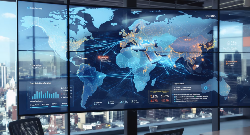
In an era where global connectivity hinges on submarine cables and secure marine infrastructure, conventional approaches have become insufficient. At Kainotomia, we reimagine marine technology as a seamless extension of digital systems thinking—not as an isolated, analog discipline.
We transcend the simplistic notion of "installing cable." Instead, we architect resilient, sovereign-aligned, digitally-traceable marine infrastructure—enhanced with sophisticated automation, proactive compliance intelligence, and comprehensive real-time data analytics that enable smarter decision-making and operational excellence.
Digital Marine Surveying & Route Analysis
Geophysical & Geotechnical Mapping
Integrated multibeam echo sounder, side-scan sonar, magnetometer, and sub-bottom profilers with custom mapping tools for real-time terrain visualization.
Autonomous Surface Vessels
Deployed for nearshore survey zones and sensitive habitats, minimising disruption and enabling 24/7 automated scanning operations.
GIS-Powered Corridor Design
Sophisticated route planning layered with marine legal zones, coral reef data, fishing traffic, sediment types, and marine biodiversity zones.
Seabed Digital Twin Models
Generated for high-risk paths, enabling pre-simulation of lay operations, plough paths, and burial profiles for optimal execution.

Intelligent Route Clearance Operations
AI-Calibrated Grapnel Runs
Pre-Lay Grapnel Runs with configurations optimised based on debris density and water depth profiles. Multiple passes ensure efficiency with minimal seabed damage.
ROV Precision Clearance
Remotely Operated Vehicle deployment for obstacle classification using underwater imaging, sonar telemetry, and LIDAR scanners in complex environments.
Debris Identification & Recovery
Comprehensive system that classifies and removes ghost nets, fishing gear, scrap metal, and marine wreckage. Each object is catalogued for compliance reporting.
Adaptive Clearance Routing
In-flight recalculations of clearance paths if sensitive marine life, uncharted debris, or terrain shifts are detected during operations.
Cable Laying & Subsea Infrastructure Deployment
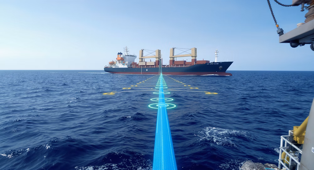
Dynamic Positioning System
Sub-meter precision during cable deployment in deep sea and congested coastal zones, maintaining optimal vessel stability and positioning.
Live Tension Monitoring
Real-time software feedback loops between Cable Laying Vessel deck and onshore command centres to ensure optimal slack and lay tension throughout operations.
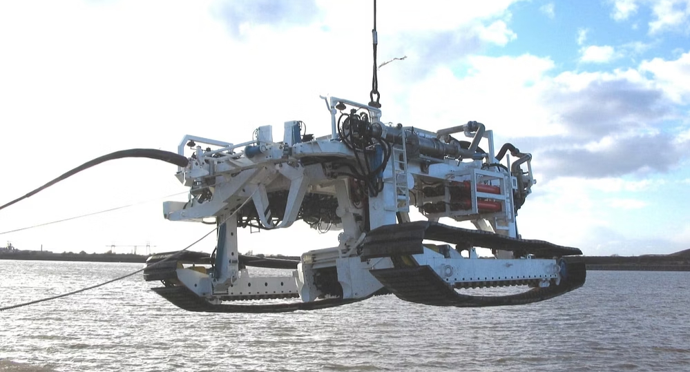
Smart Plough & Burial Tools
Jetting ploughs and tracked trenchers with load sensors and depth automation, customised to seabed composition including mud, sand, and coral shelf environments.
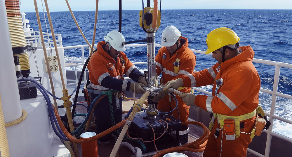
Mid-Ocean Jointing
Submerged cable jointing, armoring, and waterproofing conducted by certified technicians using advanced digital diagnostics and testing equipment.
Shore-End Works & Terrestrial Transition
Horizontal Directional Drilling
For cable beach landing through dunes, rocky cliffs, or infrastructure-heavy zones. All operations supported by 3D bore path simulations to ensure optimal trajectory and minimal environmental impact.
Beach Manhole & CLS Setup
Civil works integrated with IoT sensors for continuous monitoring of pressure, temperature, humidity, and physical access, ensuring infrastructure integrity and security at critical junction points.
Fiber Optic Splicing & Testing
Comprehensive OTDR, TDR, sheath fault detection, and inline power validation. Every connection is logged and traceable, maintaining complete documentation for future maintenance needs.
Our shore-end works represent the critical junction between marine and terrestrial infrastructure. We employ advanced engineering techniques to navigate challenging coastal environments while maintaining data integrity throughout the transition zone.
Regulatory Navigation & Environmental Compliance
Multi-Agency Engagement
Liaison with coast guard, navy, fisheries, port authorities, and national marine regulatory bodies. We speak the legal and technical languages of the sea.
Restoration & Offsetting Plans
Coral nursery funding, debris recycling, and seabed rebalancing strategies implemented post-deployment to minimise long-term impact.
Digital Environmental Impact Assessment
LLM-supported report generation and data visualisations to present complex marine impact data in digestible formats for all stakeholders.
Marine Biodiversity Mapping
Custom datasets for coral, turtle breeding grounds, fish spawning seasons, and migratory path overlays ensure eco-conscious clearance and operation.
Maritime Logistics & Support Operations
Fleet Management
Our integrated vessel scheduling system coordinates multi-vessel logistics including cable layers, support RIBs, tugboats, and crew launches to ensure operational efficiency and resource optimisation.
Each vessel is equipped with real-time positioning and communication systems, allowing for coordinated movements across complex marine environments.
Crew & Contractor Oversight
We maintain rigorous safety, insurance, certification, and compliance audits for all local and foreign crew as per International Maritime Organization standards.
Our digital credential management system ensures that all personnel are properly qualified for their specific roles and responsibilities.
Emergency Operations
Our comprehensive contingency planning includes rerouting, deep-sea repair, storm response, and incident management protocols with real-time status dashboards for all stakeholders.
Rapid response teams are strategically positioned throughout operational zones to address any technical or environmental emergencies.
Ecological Integrity by Design
Ecological Diversity as a Routing Parameter
Every mission begins with a comprehensive eco-scan that informs our routing decisions and installation methodology.
Coral Relocation Services
Specialist marine biologists carefully transplant coral formations from cable paths to nearby safe zones, maintaining ecosystem integrity.
Minimal Footprint Anchor Planning
Precision positioning systems and advanced anchor designs minimise seabed disturbance during vessel operations.
Biodegradable Materials & Carbon Offsets
We utilise biodegradable grapnel lines and contribute to carbon offset programmes for all large-scale marine operations.
We're one of the only marine firms that treat ecological diversity as a core design parameter rather than a regulatory checkbox. Our approach prioritises avoiding damage before it occurs and restoring any environments we interact with.
Featured Projects
South China Sea Network (2022–23)
Successfully implemented advanced route planning through challenging underwater terrain with comprehensive digital Environmental Impact Assessment and real-time stakeholder collaboration.
Our team deployed cutting-edge OTDR verification systems and completed thorough post-burial inspections with full documentation and transparency protocols.
Bay of Bengal Sovereign Fiber Ring
Surveyed and cleared over 20 km of cable path across a sediment-heavy, debris-rich region requiring specialised equipment and techniques.
Successfully managed multi-nation regulatory documentation and delivered early despite challenging monsoon season delays.
Our Marine Engineering Stack
| Component | Tech Stack / Tools |
| Seabed Mapping | MBES, SSS, Magnetometer, GIS |
| Clearance Tools | PLGR, ROVs, Smart Grapnels |
| Burial Equipment | Jet Ploughs, Tracked Trenchers |
| Testing Equipment | OTDR, TDR, Hi-Pot, Cable ID tools |
| Monitoring Tools | Cloud-based dashboards, UAV surveys |
| Compliance Tools | Digital EIA, Permit Tracker, Impact Models |
Our comprehensive technology stack integrates cutting-edge hardware with proprietary software systems to deliver unmatched efficiency and precision in marine infrastructure deployment. Each component is selected for reliability in harsh marine environments and seamless data integration.
Get in Touch With Our MarineTech Division
We bring intelligence to underwater infrastructure, combining advanced software systems with precision marine engineering. Contact our team today to discuss your project requirements and discover how our innovative approach can deliver superior results for your marine infrastructure needs.
Operational Locations
Headquarters: Singapore
Operational Hubs: Bay of Bengal, UAE, East Africa
Available Resources
Technical Datasheet
Project Case Studies
Environmental Impact Methodology